Join 8,000 Iceland Travel Fans & Unlock Exclusive Discounts
Get Iceland advice straight from a local. Subscribe and unlock exclusive discounts from 50+ hand-picked Icelandic operators.- ✔ Instant access to exclusive discount codes
- ✔ Savings on tours, car, and camper rentals
- ✔ Tips and inspiration for planning your Iceland trip
Jökulsárgljúfur is one of the most impressive areas in Iceland. It is in the northeastern part of the country. Its name means ‘glacial river canyon’ and is derived from the impressive canyon created by the mighty Jökulsá river (or glacial river). It is a part of a national park that bears its name. The river is fed by Vatnajökull glacier itself, from an area close to the monster subglacial volcano Bárdarbunga. This summer I went hiking Jökulsárgljúfur National Park and that was incredible.
Connected to the Diamond Circle route
Note the park’s location on the wonderful Diamond Circle route. After all, many of the main attractions of the Diamond Circle are in the Jökulsárgljúfur park. These include the waterfalls Selfoss and of course the massive Dettifoss waterfall. The park also sports the divine Ásbyrgi and the intriguing rock formation of Hljóðaklettar. The national park is perfect for hiking. I had the pleasure and privilege of hiking some 40KM in the park in two days.
Best hiking summer ever
This summer has been great for hiking by the way. I was able to hike the Fimmvörðuháls trail overnight in beautiful weather. I thought I would be pushing my luck to hope for such good conditions for the hike in Jökulsárgljúfur. But what do you know? The weather was perfect the entire time.
Hiking Jökulársgljúfur National Park in great company
I joined the hiking group ‘Vesen & Vergangur’ which is run by one of Iceland’s best hiking guides, Einar Skúlason. Some of my readers may remember him as the man behind the Icelandic hiking app ‘Wapp.’
A feast for the eyes
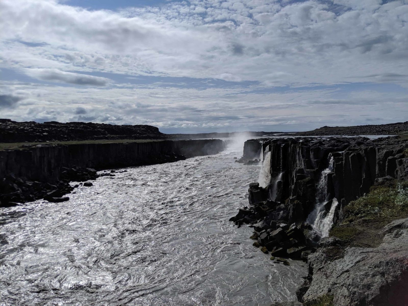
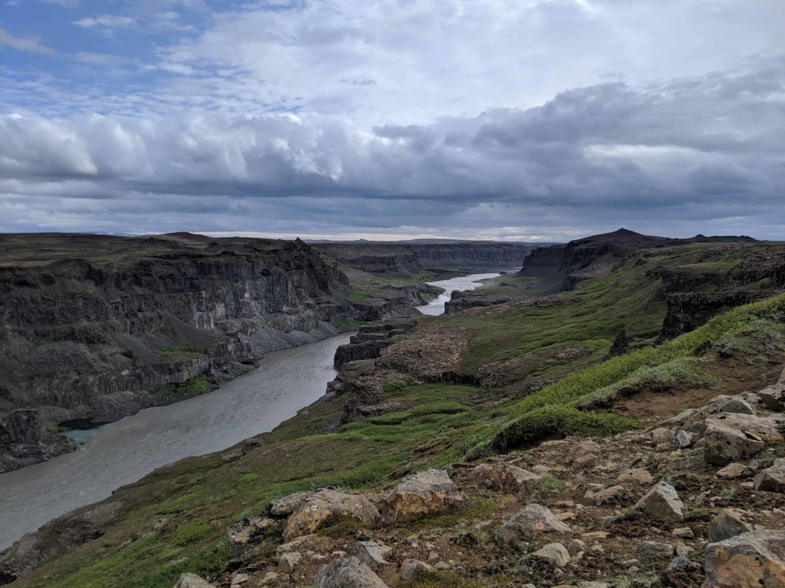
The first day of the hike would take us right down in the to the canyon where the Jökulsár river runs. The canyon itself is impressive, 25KM long and 500 meters wide. We would start next to the impressive glacial river. On our way, we would be treated to incalculable rock formations. Lovers of waterfalls would see Selfoss waterfall, Dettifoss waterfall, and Hafragilsfoss waterfall. Our hike would conclude at the camping ground at Vesturdalur which is close to Hljóðaklettar. These are called ‘Echo Rocks’ in English.
This will be part two
The second day of the hike would be Vesturdalur camping ground to Hljóðaklettar. We would ascend the Rauðhólar above Hljóðaklettar and then proceed to Ásbyrgi. We would stop right above the center of Ásbyrgi and get a fantastic view of the natural wonder.
Taking look at divine Ásbyrgi
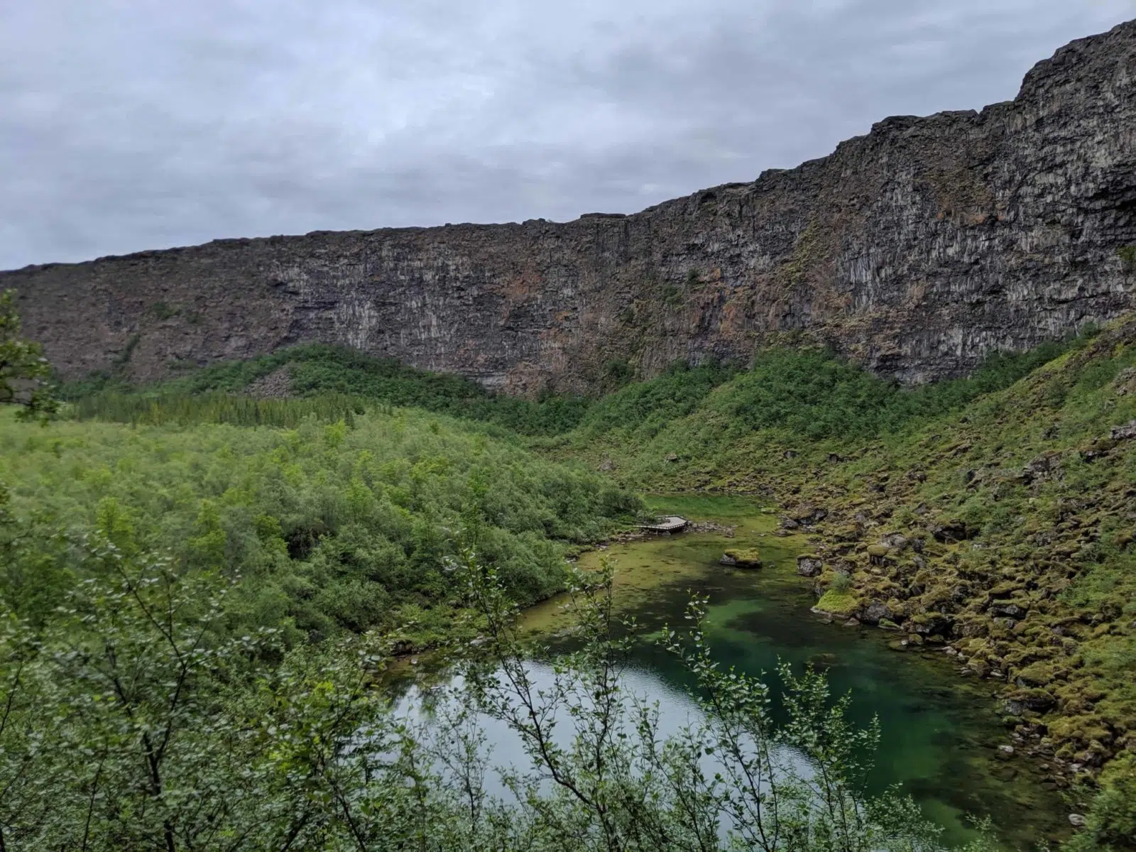
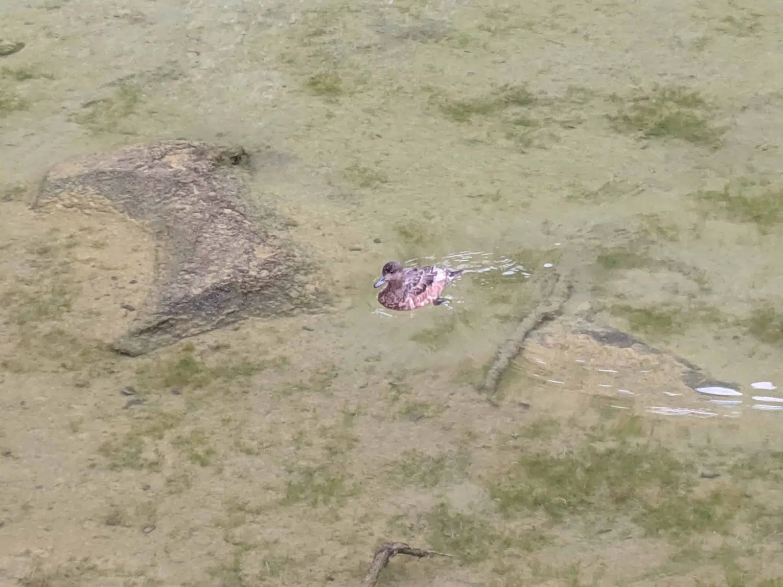
I joined my hiking group on a nice Thursday evening at Ásbyrgi. We started out with a little walk to the bottom of the Ásbyrgi to see the wonderful pond of Botnstjörn. Ducks swam serenely on the water but were surprised to see a couple of trouts in the clear water. Some jokers must have put the fish in there, the pond is not connected to any waterways with fish.
Sleipnir, the horse of Odin, created Ásbyrgi!
The myth of horseshoe-shaped Ásbyrgi is worth nothing. The story is that the King of the Norse gods, Odin, was charging on his mighty horse Sleipnir. He stepped down to Earth with a clap of thunder and mighty crash. In his wake was newly formed Horseshoe-shaped Ásbyrgi.
A result of violent events
Mythology set aside, Ásbyrgi is just like the rest of the national park, a study in violent geological events. This horseshoe-shaped depression in the landscape is surrounded by high canyons. It is the result of massive flooding. At some time after the last ice age, torrents of water would sweep from the highlands and just clear away incredible amounts of material. This would happen a few times until the modern beauty of Ásbyrgi was complete. You would not be wanting to stand where Botnstjörn pond is now. The pond is the deepest point of Ásbyrgi. It looks like a lot of the floodwater would have come down there, sweeping from the cliffs above. The pond is fed by the trickle of water seeping through the rock of the canyons. Interestingly, the sea bird Fulmar nests in the canyon and seem to have a great time soaring above it.
Camping at Vesturdalur
After having enjoyed Ásbyrgi it was time to drive to the camping ground of Vesturdalur and pitch our tents. It has water toilets and cold running water. We were all impressed how clean it was and it got dead quiet shortly after ten in the evening. Good thing too, there was an early start on Friday morning and 26 KM of hiking was ahead of us.
Starting out at Selfoss and Dettifoss waterfalls
We drove back to Ásbyrgi where a bus was waiting to take us to our starting points at Dettifoss and Selfoss. The weather was great. The sun poked through a cloudy sky and I suppose the temperature was around 15 degrees celsius. This was perfect for hiking. Our first stop was the impressive waterfall Selfoss which sits above its giant sibling, Dettifoss waterfall. Selfoss waterfall gave us a nice preview of the lovely basalt columns that adorn the Jökulsárgljúfur canyon. As somebody who is a self-confessed basalt columns enthusiast, I was in for a treat all day long.
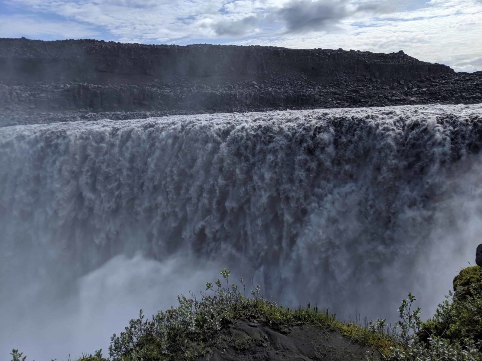
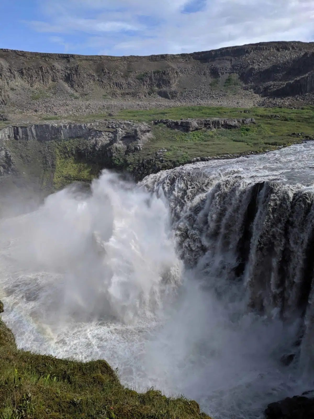
Meeting of king waterfalls on the Jökulsárgljúfur hiking trail
After photographing Selfoss waterfall we quickly moved to Dettifoss waterfall. This is, without a doubt, one of the most impressive places in Iceland. The powerful waterfall just thunders incessantly in the canyon with a growling roar. We moved on after we had adored the king of Icelandic waterfalls. Icy spray caught up with us when we moved on.
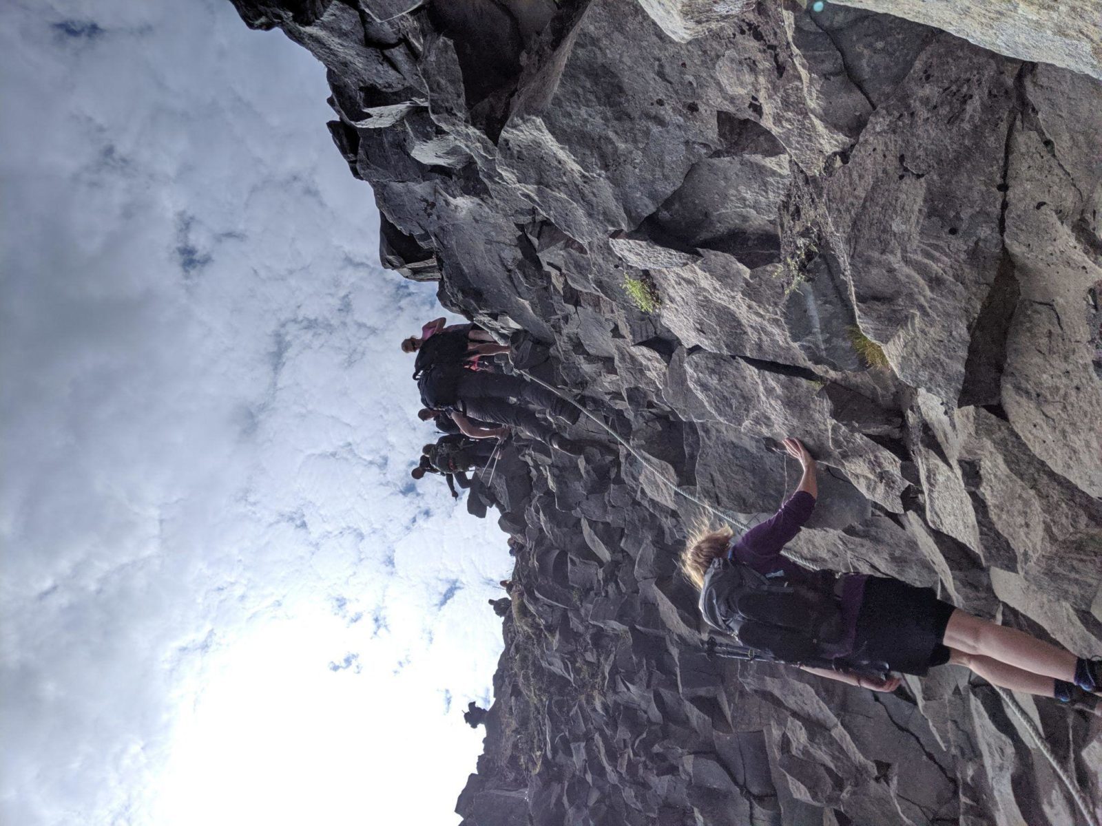
Descending into the canyon
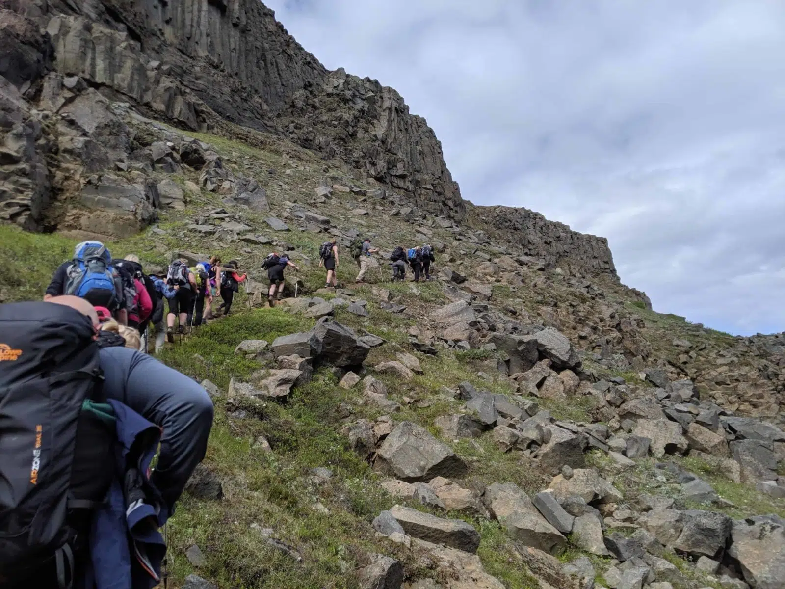
Then it was time to head right down into the canyon itself. Our descending point was steep and rocky. It had a chain to support you on the way down. This made all the difference and I found the descent easy. Of course, some found it harder than others. We are all different but everybody was able to make it down. It made a difference that everybody in the group was supportive of one another. Everybody who needed it got help.
Admiring the architecture
After a little rest at a beautiful little spot by the river, we moved on. Now when we were in the canyon itself you could see the exquisite basalt stacks everywhere. It was like walking underneath the walls of a surrealistic cathedral or formidable castles. The ‘architecture’ was like a mixture between the Sagrada Familia cathedral in Barcelona, Minas Tirith in the Lord of the Rings movies and Hallgrímskirkja cathedral in Reykjavik.
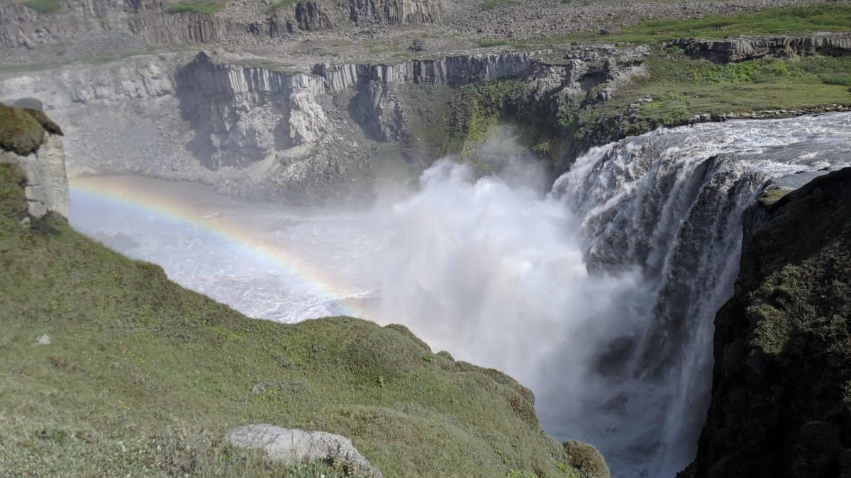
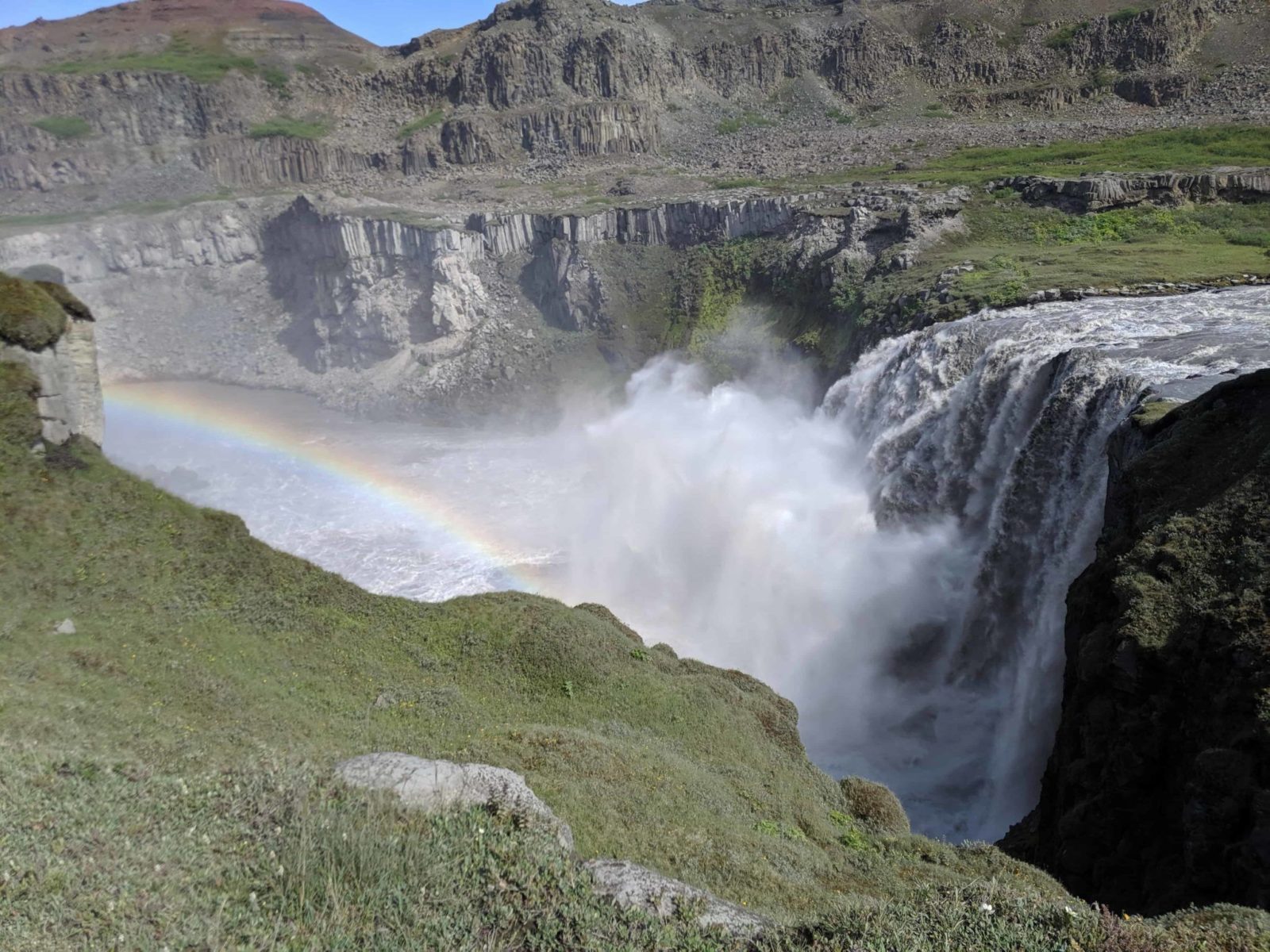
The epic Hafragilsfoss waterfall
The next waterfall was new to me. Hafragilsfoss waterfall is not high like Dettifoss. But what it lacks in height, it then makes up for it with sheer power. When the water hits the rocky riverbed it splashes upwards and this shows the power of the waterfall. We were lucky to see this in conditions where a perfect rainbow formed in the spray. My trip already was a success. I had made an acquaintance with a new and impressive waterfall.
Mixing it up
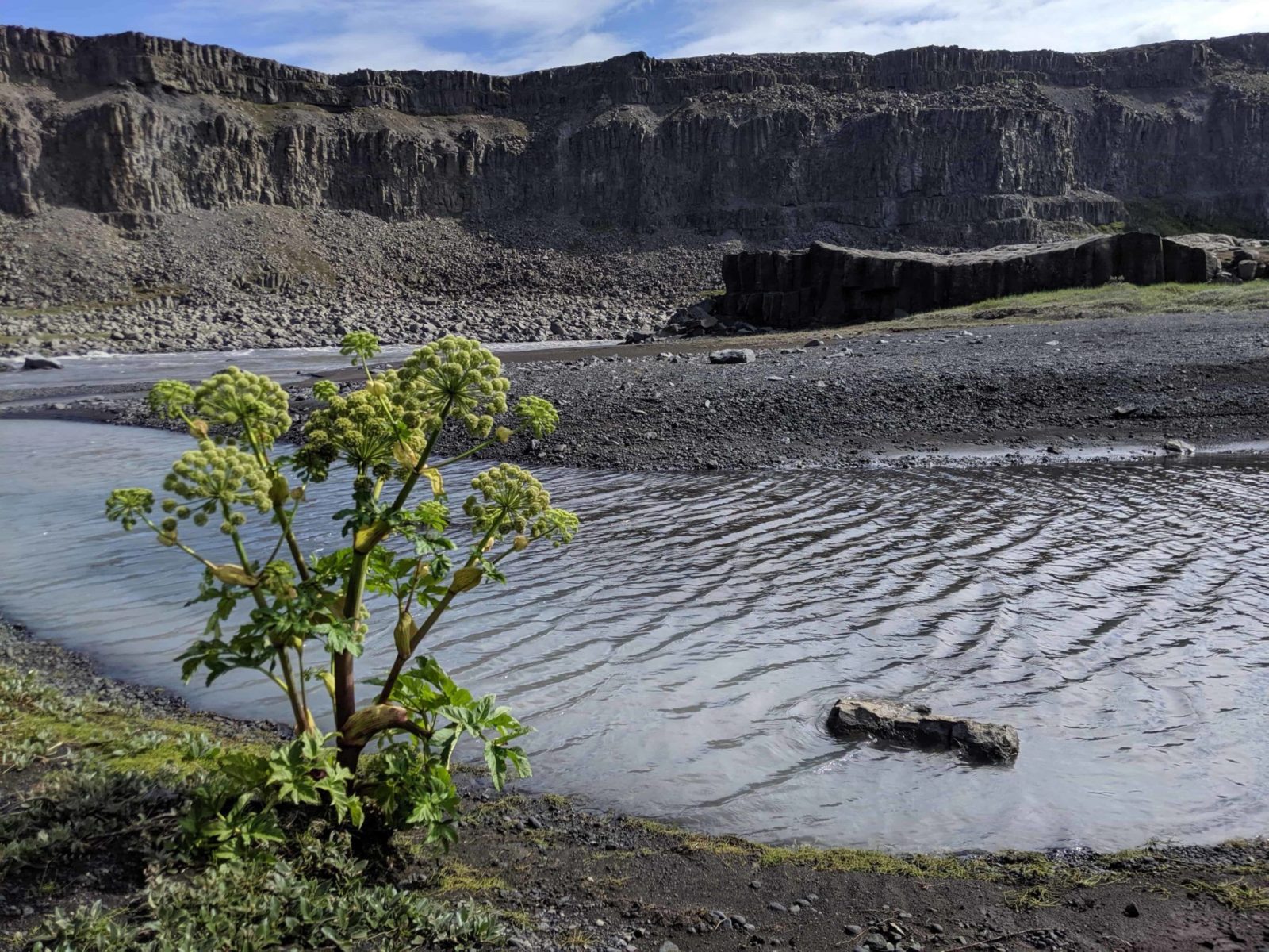
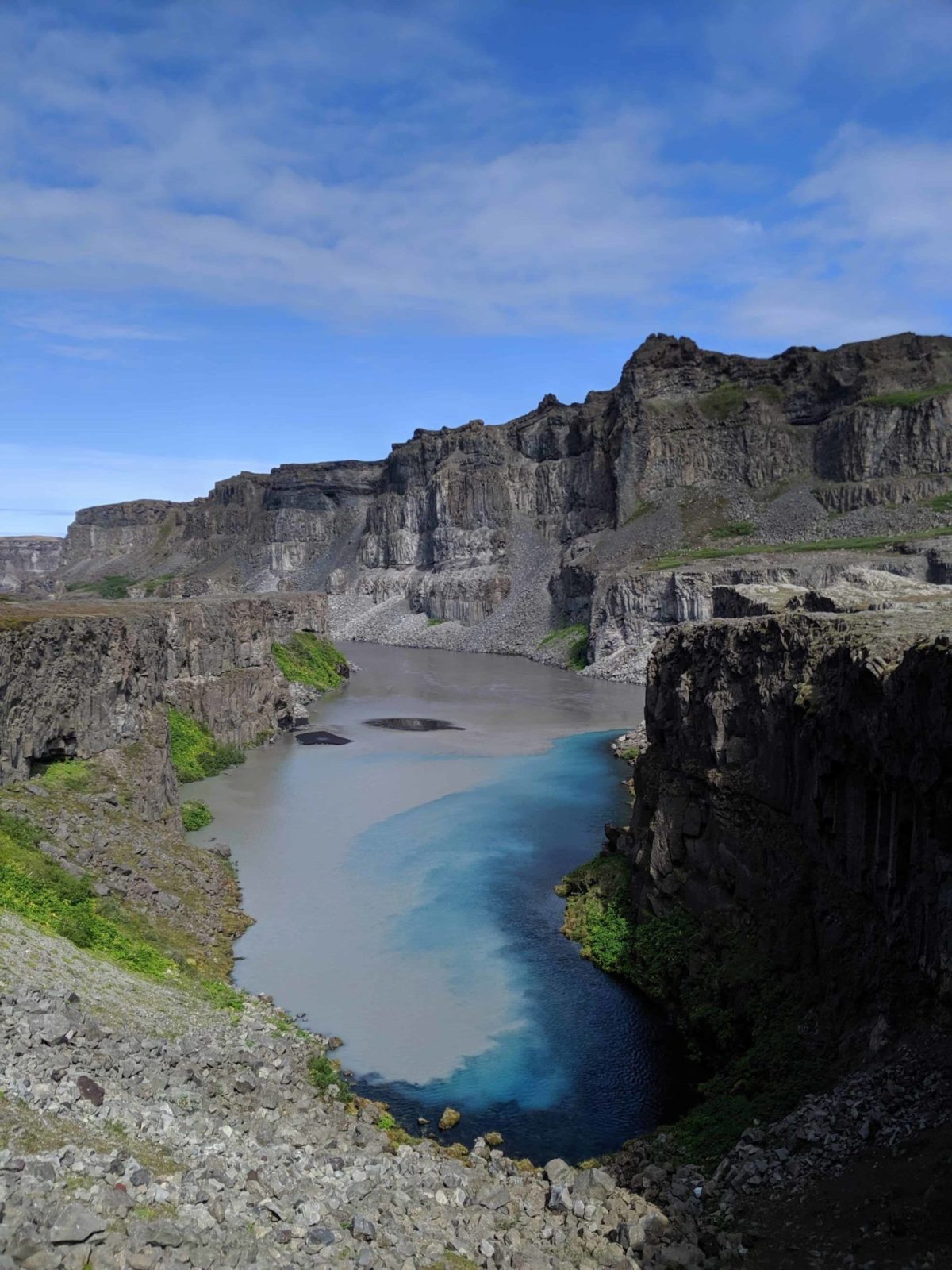
A place called Skeiðin (Spoon) was the next beauty spot. A freshwater spring feeds clear water into the muddy glacial river. The contrast of the deep blue clear water which pushes against the murky glacier water creates a beautiful interplay of colors.
Overcoming vertigo
This also where the hiking track became rocky and then narrow. On the left, there was the sheer rock face and to the left was a high drop into the canyon. Anti-anxiety drugs have worked wonders on my vertigo. I felt no fear of going there.
Ascending from the canyon
After a relatively short hike in the canyon, it was time to move on up from it. On the ascend we had impressive views over the canyon. The landscape started to change. Instead of the rocky canyon, things were getting greener. Everywhere you looked were stunning rock formations with the ever-present basalt columns.
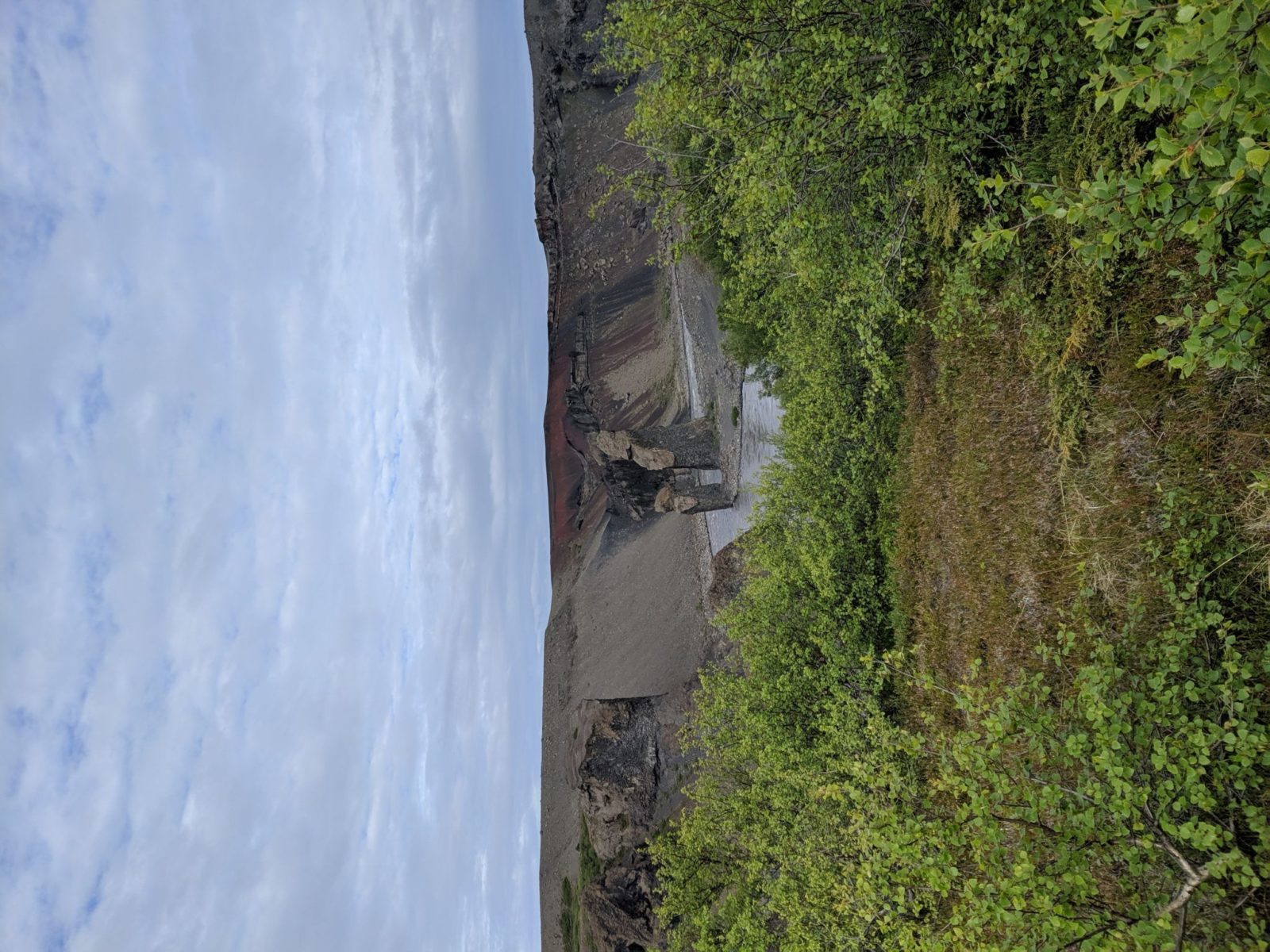
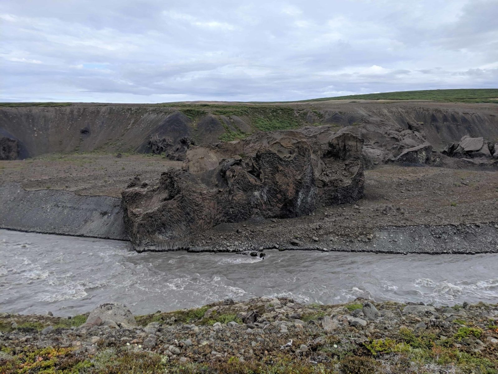
Petrified trolls in the distance
Reaching an area called Hólmatungur we saw two huge rock formations on the other side of the river. Einar explained that these were, of course, petrified remains of a troll and his wife. The story goes that they had been out partying and that the troll husband wanted more. The wife was unable to persuade her husband to come inside. Trolls will turn into stone if they are exposed to the sun and this happened when daylight hits the quarreling couple. You should always listen to your wife if she says it is time to go home!
Heading to the camping ground
After heading down into Hólmatungur it was a short way down into Vesturdalur. Einar fired up the barbeque and made everybody burgers. It is safe to say this was the perfect dinner after the 26 kilometers we had put behind. But again it was early to bed, 15 kilometers of hiking and early start waited for us the next day.
Read about the Hljóðaklettar on day two
Did you enjoy this article?
Get more Iceland insight — straight from a local who's lived here his entire life
Join 8,000 travellers getting honest Iceland advice and unlock exclusive discount codes from 50+ hand-picked Icelandic operators.- ✔ Instant access to exclusive discount codes
- ✔ Savings on tours, car and camper rentals
- ✔ Tips and inspiration for planning your Iceland trip
No spam. Unsubscribe any time.