Join 8,000 Iceland Travel Fans & Unlock Exclusive Discounts
Get Iceland advice straight from a local. Subscribe and unlock exclusive discounts from 50+ hand-picked Icelandic operators.- ✔ Instant access to exclusive discount codes
- ✔ Savings on tours, car, and camper rentals
- ✔ Tips and inspiration for planning your Iceland trip
I grew up in a cold room. My bedroom window faced directly north towards Eyjafjörður fjord, and I had messed it up one summer. I had a thing about locking my room, but one day when visiting my grandparents, who lived down the road, I predictably lost the only key. Mortified, I spent an entire afternoon breaking in through my window. After much difficulty, I succeeded without my parents finding out. But the window never fully closed after I forced it open with a screwdriver. My stepfather, who is a carpenter, never got around fixing it. On many winter nights, the north wind whooshed down from the arctic circle right past Mt. Kaldbakur and chilled my room. I still prefer to sleep in a semi-freezing room. But since then, hiking Mt.Kaldbakur had been a dream of mine.
Not ‘Brokeback’ mountain, it is ‘Coldback’ mountain!
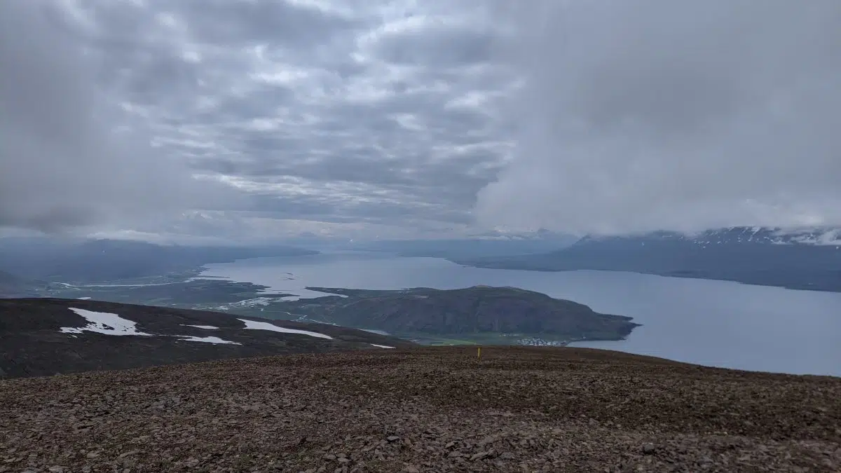
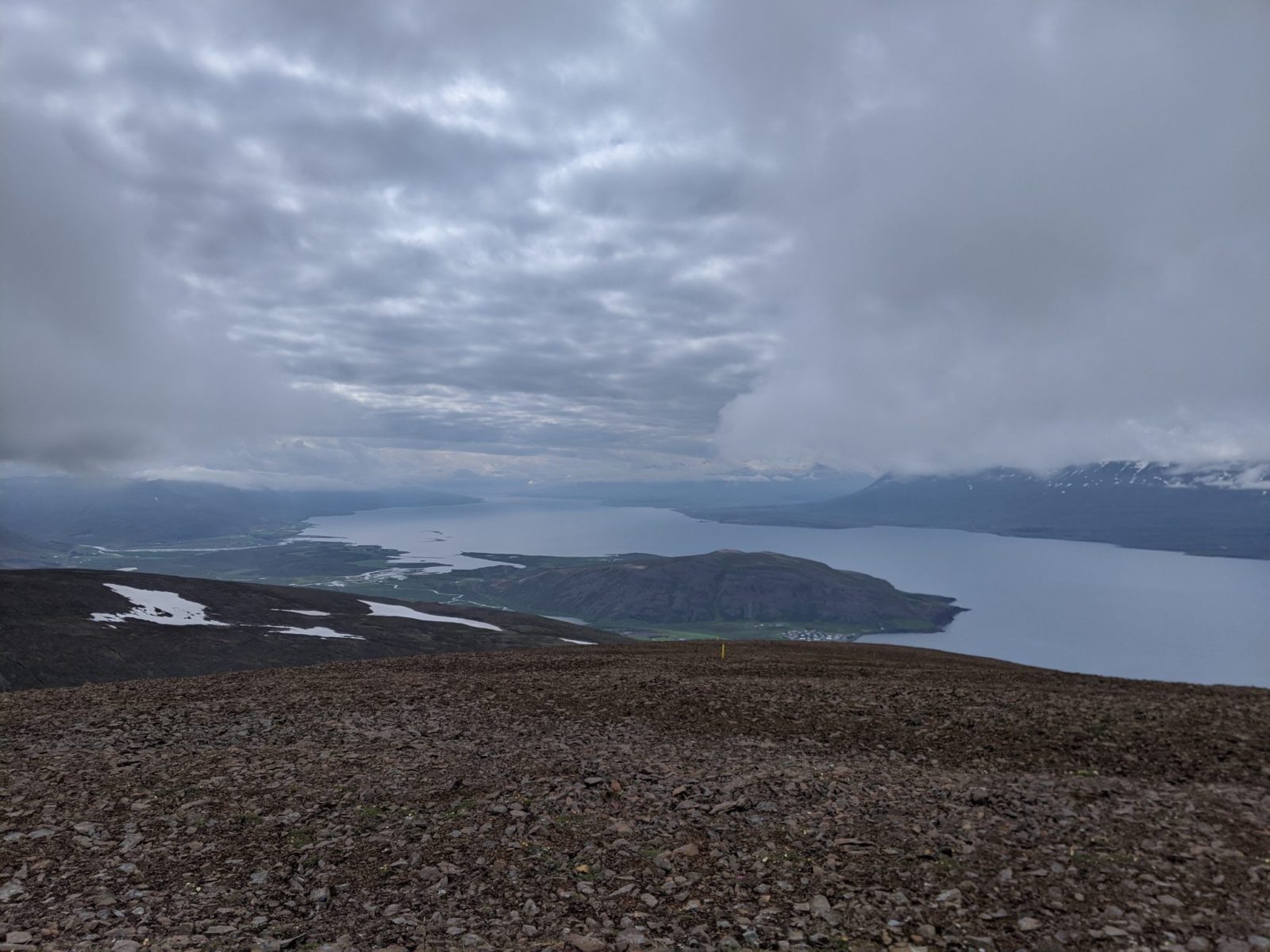
I mentioned that the northern wind travelled from the arctic circle past Mt. Kaldbakur. This mountain dominated the view from my busted bedroom window. In winter, the mountain is icy white and stands out clear days, starkly white against a blue sky. During summertime, Kaldbakur has vast tracts of snow. Its name ‘Kaldbakur’ literally means the one with a cold back.
Hiking Mt. Kaldbakur despite the cloud cover!
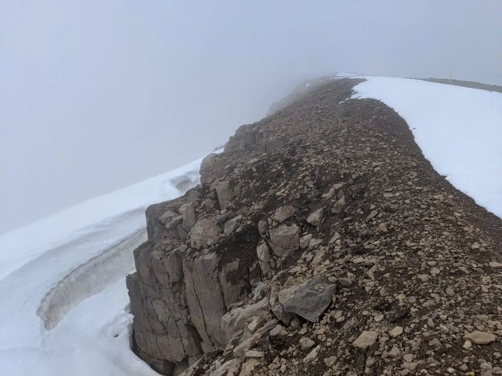
I always thought it would be a fantastic adventure to climb up that mountain and look beyond it. Fast forward some forty years, and that dream finally came true this July. However, but what lies beyond remains unseen! You see, the weather in Iceland does not always cooperate. Clouds obscure the view which is supposed to be spectacular!
Mt. Kaldbakur is 1.173 meters high (3.848 feet). It is the highest mountain in the north of the beautiful fjord Eyjafjörður where my hometown of Akureyri lies.
When my wife and I drove around the country this July, we decided to spend three nights in Akureyri. During our years together, I often talked about wanting hike up Mt. Kaldbakur, and I decided I would appear ridiculous if I didn’t follow through this time. I saw that on one day during our stay, the weather forecast looked decent enough. The cloud cover predicted would, however, limit visibility.
Failure is not an option
So I woke up 7 and drove from Hótel Kjarnalundur to the village of Grenivík. This is where you start a hike up to the top of Mt. Kaldbakur. On the way, you pass the Laufás turf farm, which is well worth visiting. It was a lovely day. Since it was overcast and no wind, visibility in all directions but south would be limited. I soldiered on nevertheless. Everything would be better than returning, admitting failure during a warm and still day.
The hike up Mt. Kaldbakur is relatively easy. It does have an elevation gain of 1.152 meters (3.780 feet), and the distance to the top is about 5.6 kilometres (3.5 miles). However, there are no climbing ice-covered peaks, struggling up steep slopes with loose rocks, or walking on razor-thin slippery high ridges. If you like that sort of thing, check out the mountain range west above Akureyri town.
Hiking Mt. Kaldbakur today? Bring water
The only thing that bothered me was the lack of running water. I had forgotten to arrange a water bottle the night before, and since I woke up before the shops opened. That turned out to be a mistake. I had been pretty sure that there would be plenty of running water on the slopes, but I was wrong. So the trek was thirsty business. I only came across one stream. Since it ran on the low elevation where sheep like to hang out, drinking from it was a little risky business. However, the water was clear and fast running. I drank from the stream and told myself if I would get sick, I would be completely alone. Nobody would witness if things got messy. I am happy to report that I had no trouble. Apart from this stream, there was only snow that could sate my thirst. Not great.
Easy work
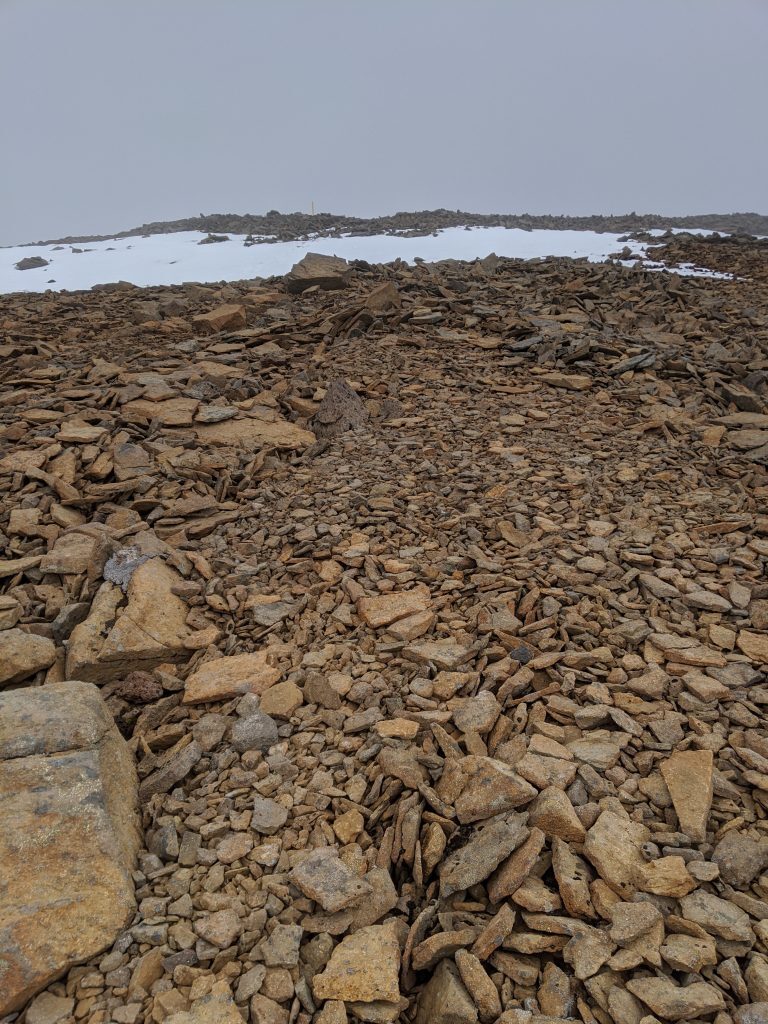
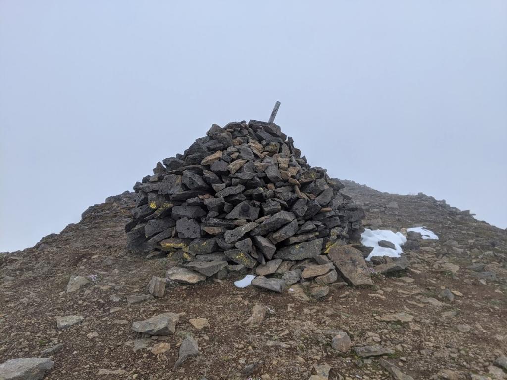
Finding your way up Mt. Kaldbakur and to the top is easy. The way to the top is one of the many hiking trails featured in the Wapp app by Icelandic hiking maestro Einar Skulason. But the trail is also clearly marked with yellow sticks. The sticks lead you from Grenivík, up to a large cairn on the mountaintop. The cairn was built in 1914 by mapmakers employed by the Danish general staff. Whether they ever believed they needed to fight a war in Iceland, I don’t know. In any case, they wanted to have proper maps of this remote part of the Danish kingdom. So from 1900 until 1940, they created high-quality maps which have stood the test of time.
I will be back
For some, following a route in an app or yellow sticks may detract from the hiking experience. Not so for me. I was completely alone on my hike, nobody else was keen on scaling the mountain on a cloudy day. I totally understand. When I reached the high plateau of Kaldbakur, I felt truly alone. As I made my way through the snow and rocky terrain, I noticed wisps of fog starting to slip over the rocks. I decided to turn back if I did not see a stick. Luckily it did not take long to see the large cairn in the distance. I hurried towards it, took the obligatory selfie, and turned around. There was a wall of white all around, just completely zero visibility to the north, east and west. But I was rewarded with a spectacular view of Eyjafjörður fjord on the way back down. But I want more and shall return to the top of the mountain that defined the view of my childhood to see beyond.
How to get there
Get the Wapp hiking app and download the Kaldbakur hiking trail. Make sure you get the one that is for the mountain called Kaldbakur in Eyjafjörður fjörd. Drive to the village of Grenivík and park to the east of the village on a parking lot there. Follow the yellow sticks up to the top.
Did you enjoy this article?
Get more Iceland insight — straight from a local who's lived here his entire life
Join 8,000 travellers getting honest Iceland advice and unlock exclusive discount codes from 50+ hand-picked Icelandic operators.- ✔ Instant access to exclusive discount codes
- ✔ Savings on tours, car and camper rentals
- ✔ Tips and inspiration for planning your Iceland trip
No spam. Unsubscribe any time.