Join 8,000 Iceland Travel Fans & Unlock Exclusive Discounts
Get Iceland advice straight from a local. Subscribe and unlock exclusive discounts from 50+ hand-picked Icelandic operators.- ✔ Instant access to exclusive discount codes
- ✔ Savings on tours, car, and camper rentals
- ✔ Tips and inspiration for planning your Iceland trip
There are loads of great hiking trails around Reykjavik. We love to hike Mount Esja, but it can be a bit of a challenge for beginners. If you are looking for something easier, the Búrfellsgjá hiking trail might be the right thing for you.
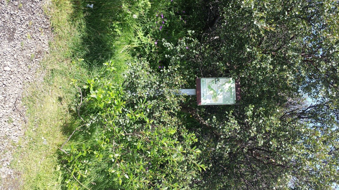
The Búrfellsgjá hiking trail is pretty popular, but it is tricky to find for the uninitiated. To reach it from the town of Gardabaer just outside of Reykjavik, you need to drive south-west on road 408 (Heiðmerkurvegur Road) until you reach a sharp bend in the road. Park your car there, you will (hopefully) see a sign in Icelandic, almost covered in vegetation. This sign gives some vague instructions and is best ignored.

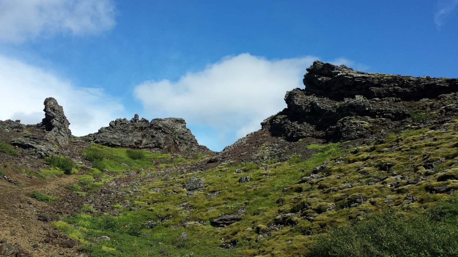
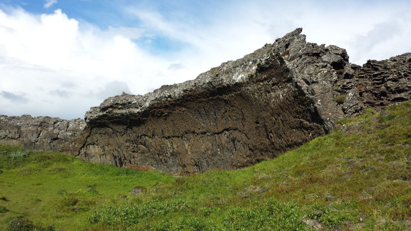
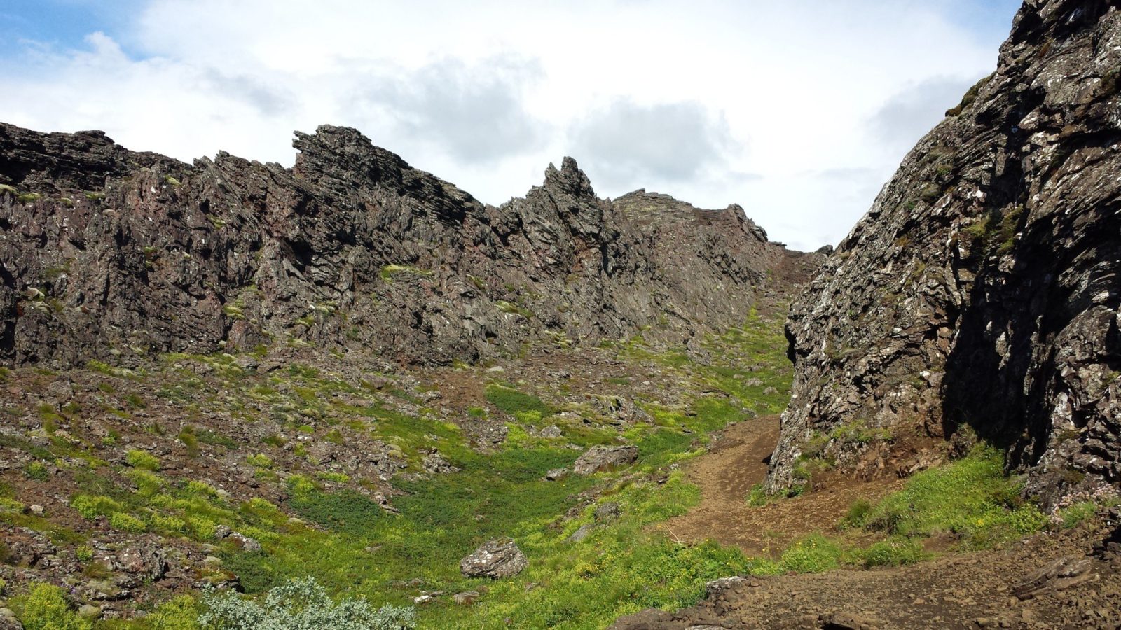
Cross the road (carefully) and follow the trail to a wooden stairway directly to the south, and you are on your way. The name “Búrfellsgjá” basically means “The Crevice of Búrfell” and derives its name from the nearby hill of Búrfell, which is at the end of the hiking trail. Búrfellsgjá is a shallow crevice or indentation that was formed in an eruption at the Búrfell hill some eight thousand years ago.
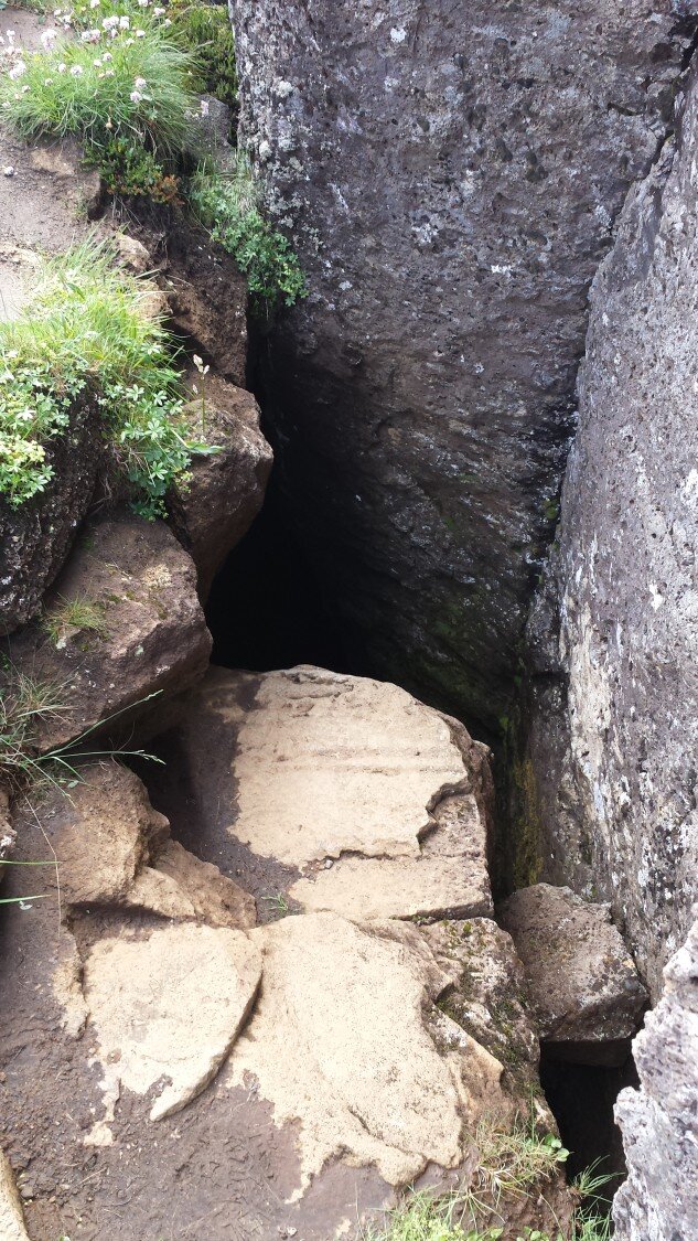
Pretty soon, the trail takes you past a deep crevice with a water well at the bottom. If you are thirsty and crave the water below, you need to climb down six meters. Please be careful if you attempt this. This used to be the only water source for sheep herders and travelers in the days of old. Another relic of Iceland´s agricultural past is just past the well. It is a sheepfold built in 1839, with an enclosure and shelter for the thirsty sheep herders we mentioned earlier.
On the way to Búrfell, you will see impressive rock and lava formations, including one that looks like a stage made from and for rock. Get it?
The hill of Búrfell is only 179 meters high and has a nice view of the Reykjanes peninsula. The hike is 5,5 km long, and if you take it really slowly, it will take just under two hours. Have a nice trip and don´t forget your camera 🙂

Did you enjoy this article?
Get more Iceland insight — straight from a local who's lived here his entire life
Join 8,000 travellers getting honest Iceland advice and unlock exclusive discount codes from 50+ hand-picked Icelandic operators.- ✔ Instant access to exclusive discount codes
- ✔ Savings on tours, car and camper rentals
- ✔ Tips and inspiration for planning your Iceland trip
No spam. Unsubscribe any time.